A high-performing land surveying website should help a property owner, developer, contractor, attorney, architect, engineer, or title professional answer four questions quickly: does this firm handle my type of survey, does it work in my location, can I trust its process, and what information is needed to request the project? The strongest land surveying website design examples translate technical expertise into a clear path from an uncertain need to a qualified project conversation.
The ten concepts below show how land surveying firms can use precise positioning, field-to-finish visuals, useful service guidance, parcel-based request forms, representative project maps, and credible technology explanations. Each layout is intentionally clean, spacious, and mobile-friendly so decision-makers can understand the next step without navigating a text-heavy technical presentation.
Land surveying website design examples: quick overview
- Field-to-finish hero: Connect survey crews, professional oversight, field equipment, and decision-ready deliverables in one concise first screen.
- Visual service selector: Help visitors identify the appropriate path for boundary, topographic, ALTA/NSPS, construction staking, platting, or as-built needs.
- Guided project request: Collect the parcel address, project purpose, timing, available documents, and contact details before the firm reviews scope.
- Project and service map: Show representative experience and geographic coverage without exposing confidential client or parcel information.
- Technology and deliverables: Explain GNSS, robotic total stations, drones, LiDAR, CAD, or GIS through the outcomes they support when applicable.
- Field-to-finish process: Make research, fieldwork, analysis, quality review, and delivery easy to understand.
- Land-development coordination: Give developers, engineers, architects, and contractors a dedicated path for multi-stage project needs.
- Credentials and standards: Present professional licenses, jurisdictions, associations, insurance, and standards accurately and visibly.
- Local relevance: Build useful service-area pages around real coverage, available services, and nearby experience.
- Bilingual access: Carry the project-request journey through English and Spanish when the operating team supports both languages.
What a high-performing land surveying website needs
People often arrive at a surveying website knowing the outcome they need but not the exact service name. A buyer may need due-diligence support, a homeowner may have a boundary question, a contractor may need staking, or a civil team may need existing-condition data. The website should provide enough guidance to route the request while making it clear that final scope, availability, fees, and schedule follow professional review.
| Website element | What it should accomplish |
|---|---|
| Service clarity | Explain common survey types, typical use cases, required inputs, and important limitations in language clients can understand. |
| Defined coverage | Show the jurisdictions and markets served, along with any project-based travel or service limitations. |
| Qualified project request | Collect parcel, purpose, schedule, document, and contact information without presenting the form as an instant quote. |
| Relevant proof | Connect representative project types, client sectors, deliverables, and challenges to the service being considered. |
| Verifiable trust | Present professional credentials, standards, insurance, associations, and reviews accurately and in context. |
| Field-to-finish follow-through | Set expectations for research, site access, fieldwork, coordination, quality review, delivery, and project communication. |
A focused website design strategy connects search visibility, technical credibility, useful qualification, and responsive follow-up into one business-development system.
1. Lead with a field-to-finish value proposition
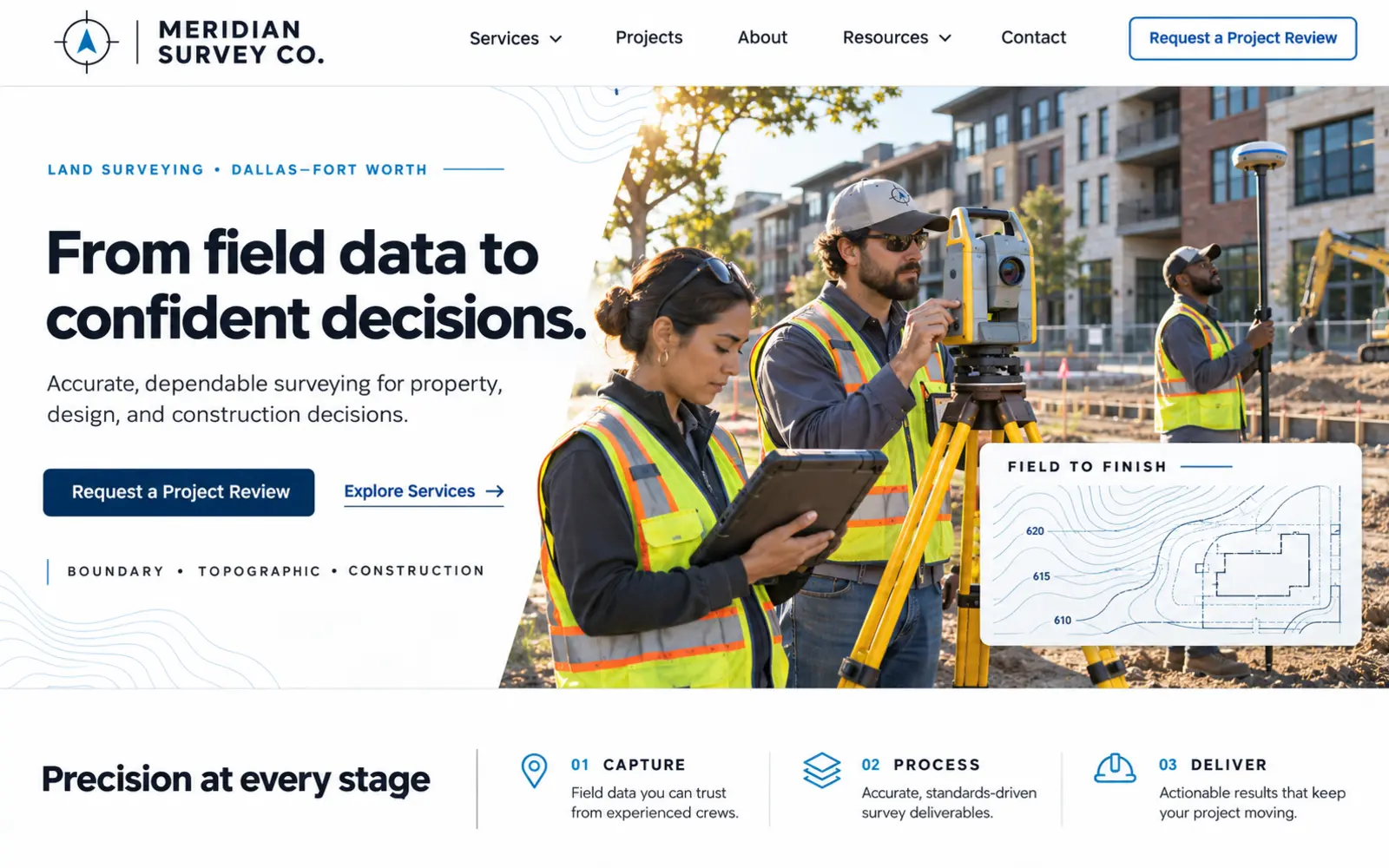
The first screen should make a technical firm feel capable, clear, and approachable. This concept pairs an authentic survey crew using field equipment with a concise promise such as “From field data to confident decisions.” A restrained interface gives visitors three immediate signals: the markets served, the types of work supported, and a Request a Project Review action.
The visual can connect fieldwork to a clean contour drawing, boundary exhibit, point cloud, or plan detail without turning the hero into an equipment catalog. Supporting copy should explain the benefit—reliable information for design, due diligence, construction, or property decisions—while deeper pages describe the firm’s actual services and deliverables.
Use one primary action and one secondary path to services or representative work. Avoid universal claims about accuracy, turnaround, coverage, or technology. Those details depend on scope, site conditions, research, jurisdiction, access, and the firm’s professional review.
2. Organize surveying services with a visual selector
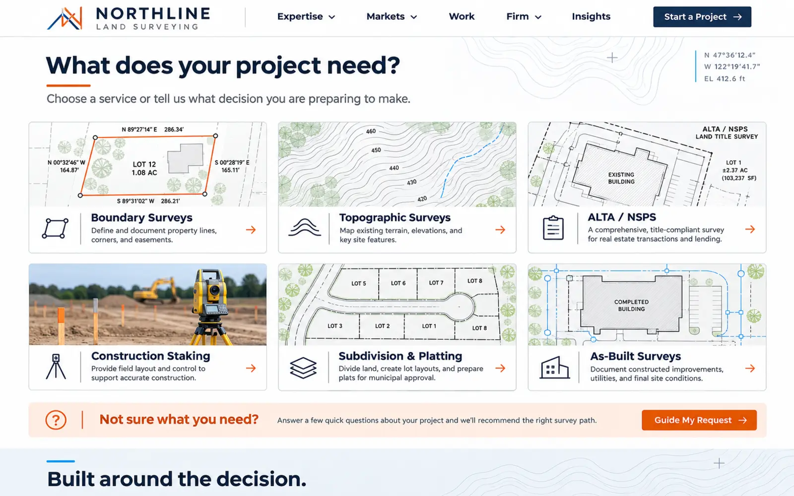
Surveying terminology can be unfamiliar to customers and highly specific to the project. This concept uses a precise grid of visual service cards for boundary surveys, topographic surveys, ALTA/NSPS Land Title Surveys, construction staking, subdivision or platting support, and as-built surveys. Each card pairs a concise explanation with the decisions that service commonly supports.
A short “Not sure what you need?” path can ask whether the request relates to a purchase, design, permit, boundary question, construction activity, or completed improvement. The resulting page should guide the visitor toward a conversation rather than making a professional determination from a few clicks.
Only show services the firm actually provides in the relevant jurisdiction. Explain when title work, legal documents, engineering, utility locating, architectural services, or other outside information may be required, and avoid treating similar survey types as interchangeable.
3. Build a guided project request with parcel and document upload
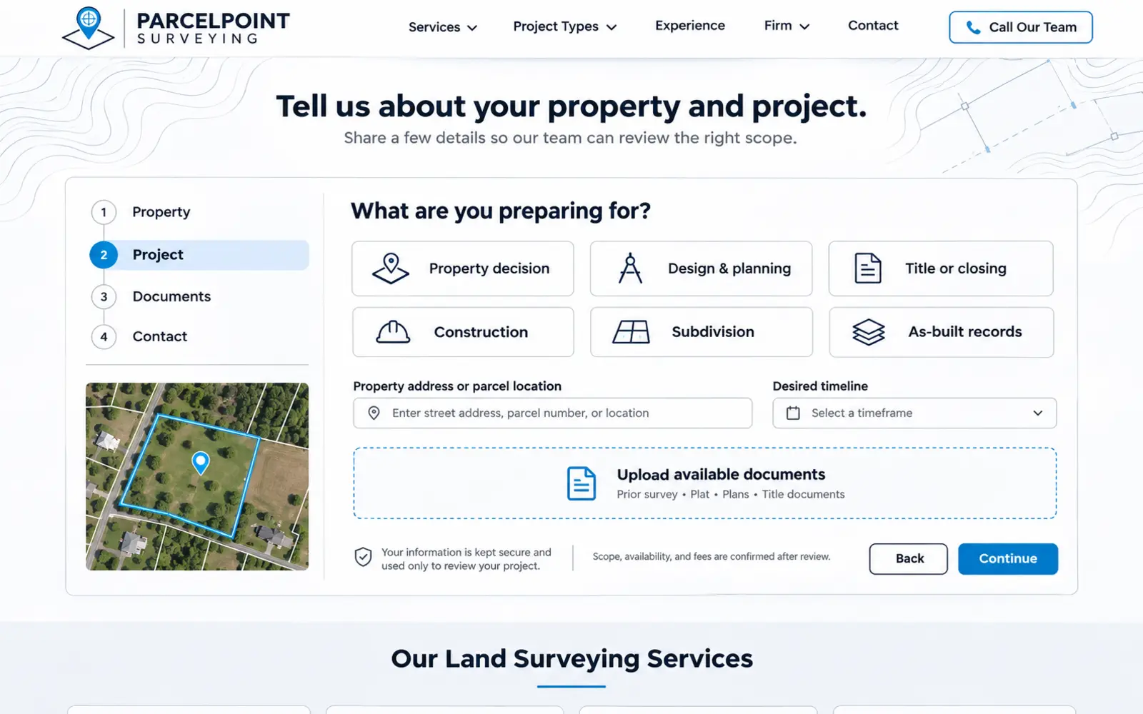
A generic contact form rarely gives a surveying team enough context to evaluate a request. This concept uses a short, structured sequence: enter the property address or parcel location, select the project purpose, describe the desired outcome, share timing, upload available documents, and provide contact information. A progress indicator keeps the experience manageable.
Useful uploads may include a prior survey, title commitment, legal description, plat, site plan, construction plan, or marked exhibit when available. The form should explain accepted file types, privacy practices, and that documents support an initial review rather than establish final scope or price.
The confirmation screen should set a realistic next step: the firm will review the property, project purpose, records, access, jurisdiction, schedule, and requested deliverables before confirming availability and preparing an estimate or requesting more information. This qualification protects both the client experience and the technical team’s time.
4. Connect representative projects to the service-area map
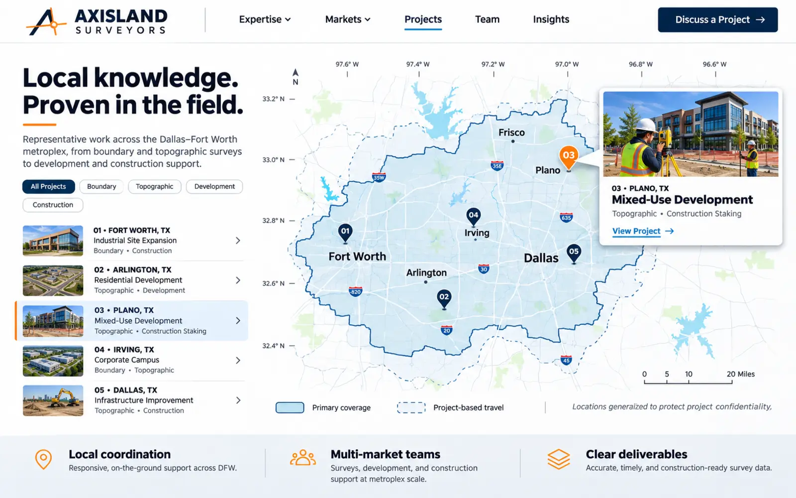
A service-area list communicates reach, but a well-designed map can communicate context. This concept combines a clean Dallas–Fort Worth coverage map with filters for project type, market, and service. Selecting a representative pin reveals a short card with the challenge, service category, deliverable, and general project area.
The map can help a developer find land-development experience, a contractor see construction staking work, or a property professional understand local coverage. Pair it with an accurate explanation of the firm’s primary territory, project-based travel, and any jurisdictional limitations.
Protect confidential or sensitive information. Generalize locations, remove parcel identifiers, and secure permission before publishing client names, plans, coordinates, or identifiable deliverables. Representative project proof should build confidence without exposing protected project data.
5. Explain survey technology through useful deliverables
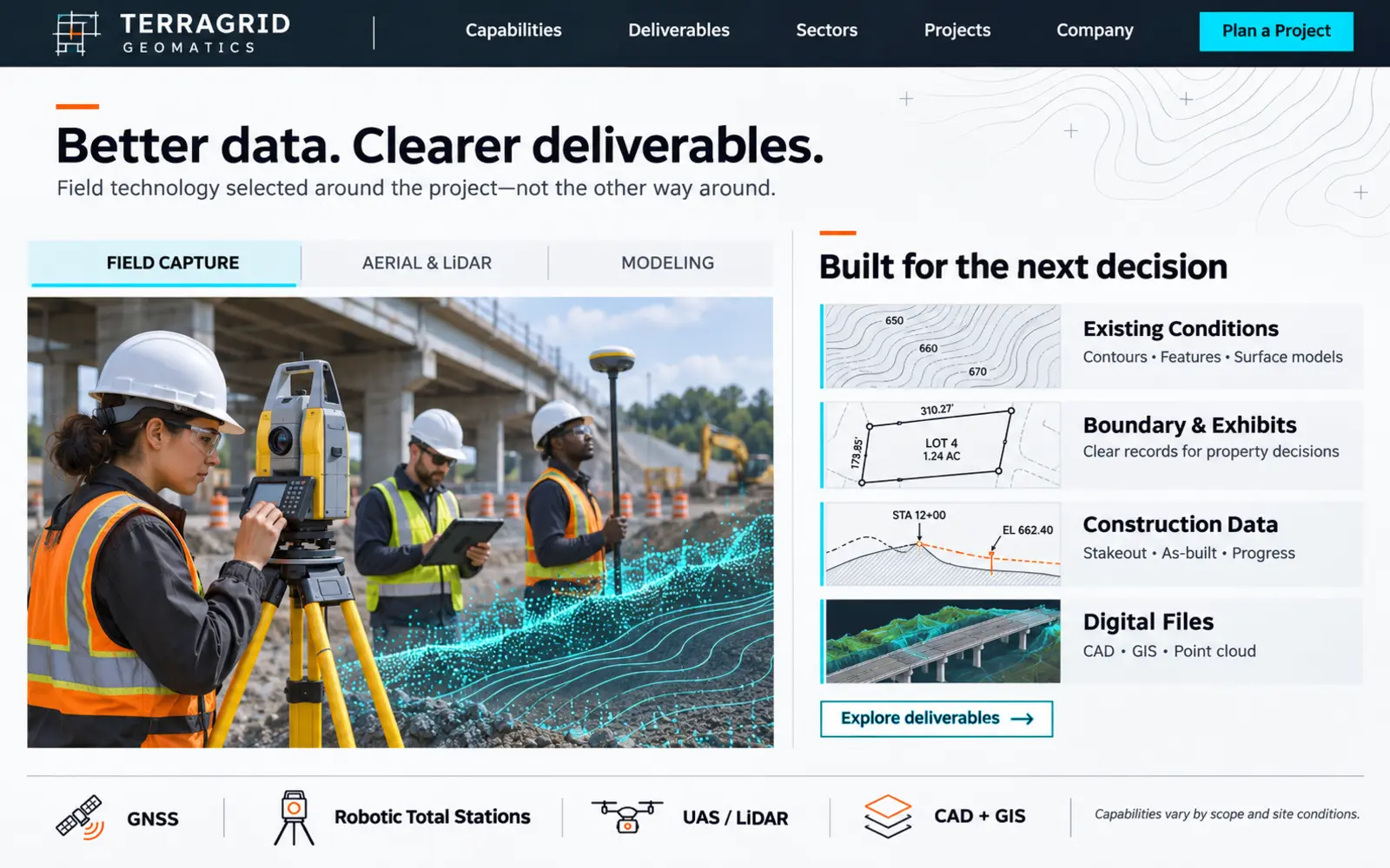
Technology is persuasive when clients understand what it helps produce. This concept uses a restrained technical dashboard that connects field and processing tools to outcomes: existing-condition data, surface models, contours, boundary exhibits, stakeout information, as-built documentation, CAD files, GIS-ready data, or point-cloud deliverables where appropriate.
A firm may use GNSS receivers, robotic total stations, digital levels, drones, LiDAR, scanners, CAD, or GIS depending on its services and project requirements. Explain capabilities accurately, show the conditions in which each method is useful, and describe how professional judgment and quality control remain part of the process.
Avoid implying that one device guarantees a particular accuracy, schedule, or legal outcome. Drone operations, data collection, processing, deliverable formats, and professional oversight must align with project scope, site conditions, applicable rules, and the services the firm is qualified to provide.
6. Show the field-to-finish process and quality controls
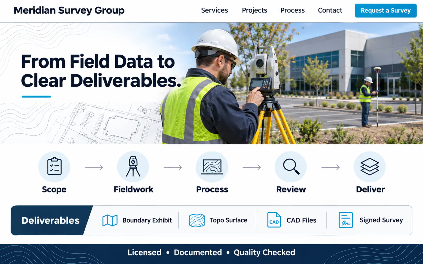
Clients often see only the crew onsite and the final document. This concept reveals the work between those moments through five concise stages: project review and records research, field planning and access coordination, data collection, office analysis and drafting, and quality review and delivery.
Each stage can answer one practical question. What information does the client provide? What site access is needed? What can affect schedule? Who coordinates with the project team? Which deliverables and file formats were agreed to? Clear expectations reduce uncertainty without overwhelming visitors with a technical manual.
The interface should acknowledge that processes vary by service. Boundary work, topographic data collection, construction staking, platting support, and as-built documentation may involve different research, field procedures, approvals, coordination, and review.
7. Create a dedicated land-development coordination path
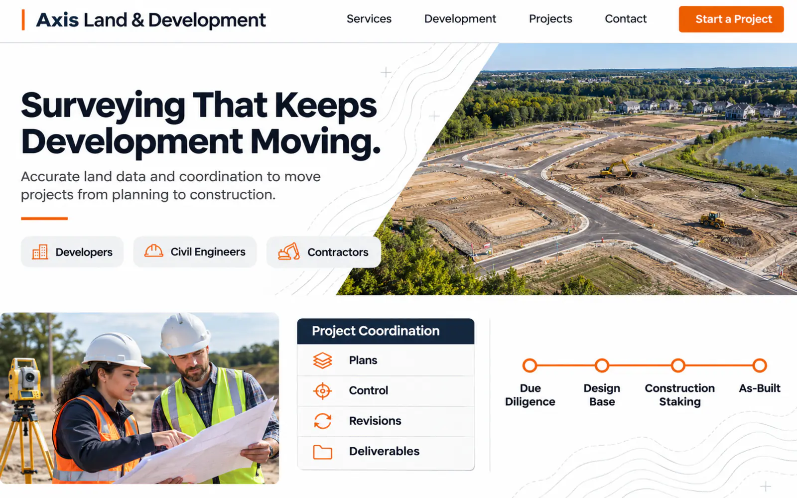
Development teams need to understand how a surveying firm can support several project phases. This concept uses a horizontal project timeline—due diligence, existing conditions, entitlement or platting support, design coordination, construction staking, and closeout documentation—with the applicable services clearly identified.
Dedicated paths for developers, civil engineers, architects, general contractors, and public-sector teams can explain coordination practices, common inputs, file standards, communication, and representative experience. A project-team request form can collect the site, phase, disciplines involved, anticipated milestones, and documents available.
Keep professional scopes distinct. Do not imply that surveying includes engineering, architecture, title, legal, permitting, or construction services unless the company is qualified and contracted to provide them. Clear roles make the firm easier to engage and reduce avoidable scope confusion.
8. Make credentials and professional standards easy to verify
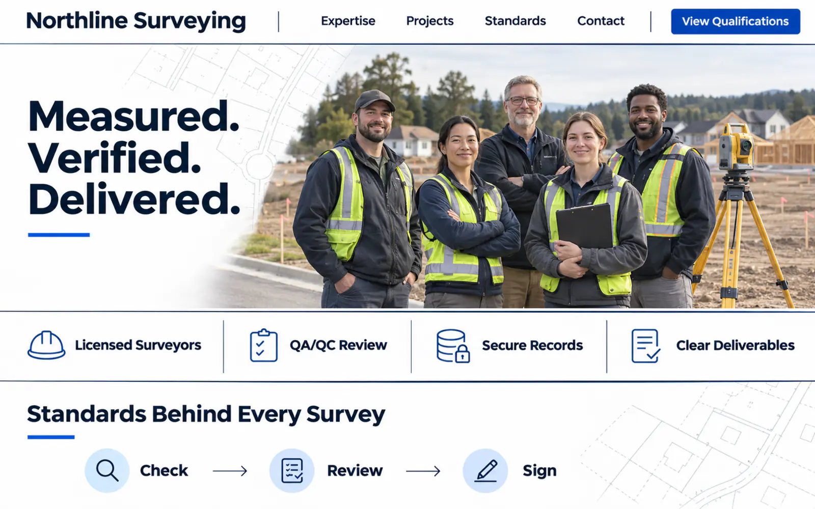
Technical credibility should be visible before the visitor reaches the footer. This concept introduces the professional leadership team with clear roles, relevant experience, license jurisdictions, market expertise, and direct paths for project communication. A compact standards panel provides context for current associations, insurance, safety practices, and quality procedures.
Credentials should be specific and verifiable. List the applicable professional license holder and jurisdiction accurately, keep renewal information current, and avoid presenting association membership or equipment certifications as substitutes for professional licensure.
Pair credentials with proof of communication and delivery: representative project types, client sectors, concise testimonials, response expectations, and the field-to-finish process. Trust grows when qualifications and the client experience reinforce each other.
9. Build useful Dallas–Fort Worth service-area pages
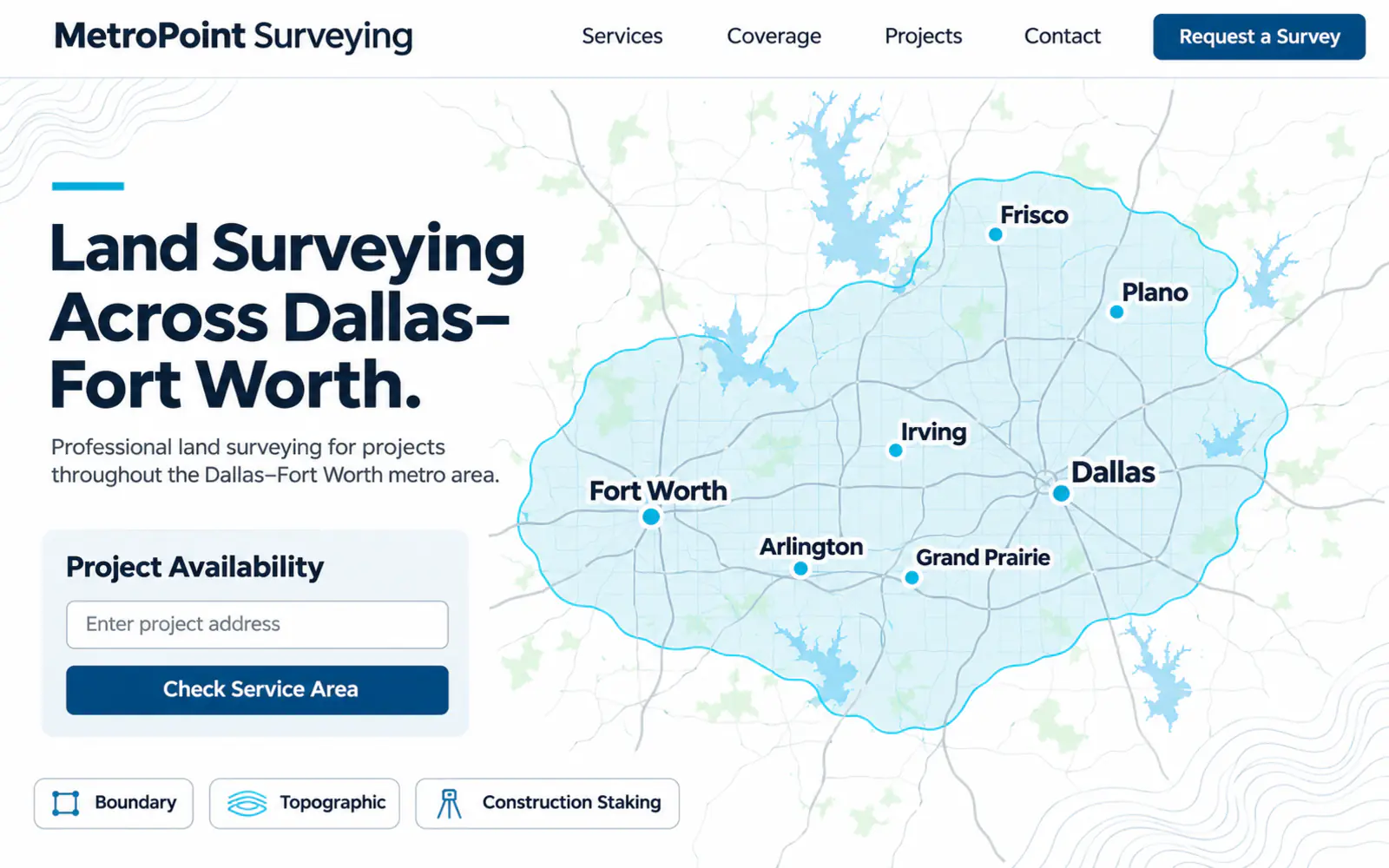
A useful local page does more than repeat the same text with a different city name. This concept combines the services available in a market with relevant jurisdictions, property or project types, representative nearby work, realistic scheduling factors, and a request form routed to the correct team.
Pages for Dallas, Fort Worth, Arlington, Plano, Frisco, Irving, or other genuinely served areas should reflect real coverage and operational knowledge. Explain whether the firm works throughout a region, within specific counties, or travels for projects that meet certain criteria.
Accurate business information, strong internal links, current local proof, fast pages, and focused service content support search visibility. Avoid mass-producing thin location pages or implying immediate availability in every market.
10. Create a complete bilingual project journey
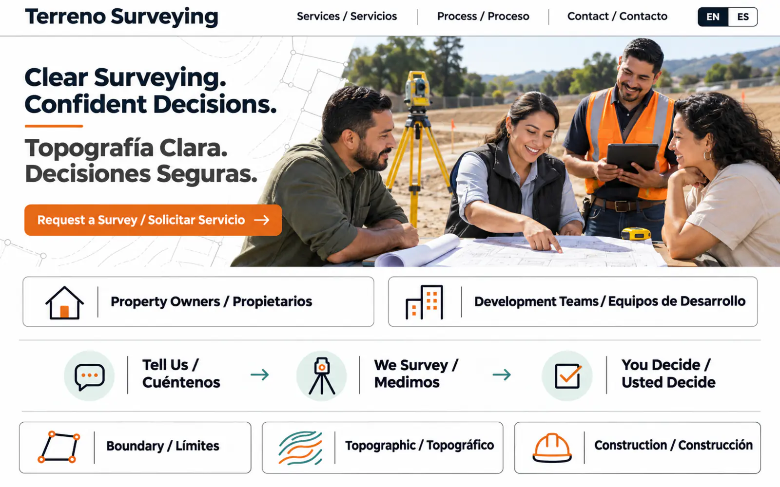
A language toggle creates value only when the complete project journey supports it. This concept gives English- and Spanish-speaking visitors equal access to service explanations, project-purpose guidance, document-upload instructions, validation messages, confirmations, scheduling expectations, and contact options.
Professional translation should preserve the meaning of technical and legal terminology while keeping client-facing language understandable. Service names, limitations, deliverable descriptions, privacy information, automated messages, and FAQs should remain consistent in both languages.
The operating team must be able to respond accurately in the client’s preferred language. Hispanos Marketing treats bilingual communication as part of a complete multicultural customer experience—not a decorative addition to the interface.
Land surveying website design checklist
- The homepage explains the firm’s value, primary services, coverage, professional trust, and next step within the first screen.
- Service pages explain common use cases, required inputs, deliverables, limitations, and the correct request path.
- The project form collects parcel, purpose, timing, documents, and contact details without promising an instant quote.
- Boundary, topographic, ALTA/NSPS, staking, platting, as-built, drone, LiDAR, and GNSS content appears only where applicable.
- Technology is connected to useful client outcomes rather than presented as an unsupported equipment list.
- The field-to-finish process sets expectations for research, access, fieldwork, review, coordination, and delivery.
- Project examples explain the situation, service, deliverable, and value without exposing confidential information.
- Professional licenses, jurisdictions, insurance, associations, and standards are current and verifiable.
- Service-area pages provide useful local information and accurately reflect operational coverage.
- English and Spanish journeys are complete when bilingual service is offered.
- The website is fast, accessible, secure, and easy to use on a phone or at a jobsite.
- Forms, calls, document uploads, qualified opportunities, and lead sources are measured securely.
If the initial cost and ongoing upkeep of a traditional site are barriers, explore our managed website plans. They combine a professional website framework with hosting, routine maintenance, and technical support in one monthly plan.
Frequently asked questions about land surveying website design
What should a land surveying website include?
A land surveying website should clearly present services, coverage, client sectors, project examples, professional credentials, the field-to-finish process, FAQs, contact information, and a qualified project-request form. Depending on the firm, it may also need a service map, document upload, development-team resources, deliverable examples, technology information, or bilingual content.
How can a land surveying website generate more qualified project requests?
Help visitors connect their project purpose to the appropriate service, confirm geographic fit, see relevant experience, and submit the parcel address, desired outcome, schedule, and available documents. Focused service pages, local visibility, realistic expectations, secure routing, and prompt follow-up improve request quality together.
Should a surveying website provide instant quotes?
An instant quote may be inappropriate when cost depends on records research, parcel conditions, acreage, access, vegetation, improvements, jurisdiction, required deliverables, project purpose, schedule, and available information. A guided request can collect the right inputs, but the firm should review scope before confirming fees and availability.
How should land surveying services be organized?
Organize services around both survey type and client purpose. Clear pages for boundary, topographic, ALTA/NSPS, construction staking, subdivision or platting support, and as-built work can be paired with paths for property decisions, due diligence, design, development, construction, and closeout—only where the firm provides those services.
Should a land surveying website feature drones, LiDAR, or GNSS?
Feature technology when it is part of the firm’s real capabilities and explain the project outcomes it supports. Equipment should not be presented as a substitute for professional judgment or as a guarantee of accuracy, schedule, or suitability. Capabilities, oversight, and deliverables should match the scope and applicable requirements.
How often should a land surveying website be updated?
Update services, coverage, licenses, leadership, project examples, technology, deliverable formats, and FAQs as they change. Review forms, file uploads, tracking, integrations, page speed, accessibility, security, privacy, and mobile usability routinely.
Build a land surveying website around the project decision
The best land surveying website is not the one with the longest equipment list. It is the one that helps the right client identify a likely service, verify technical credibility, share useful project information, and enter a professional scope conversation with confidence.
Hispanos Marketing designs conversion-focused websites for land surveying firms, engineering teams, contractors, and professional service businesses in Dallas–Fort Worth and nationwide. Explore our engineering firm website examples, construction company website examples, home builder website examples, concrete contractor website examples, and paving company website examples, or review our website design service.
Book a call with Hispanos Marketing to plan a modern land surveying website built to turn technical expertise into qualified project requests.